The Buoy
Meet the buoy
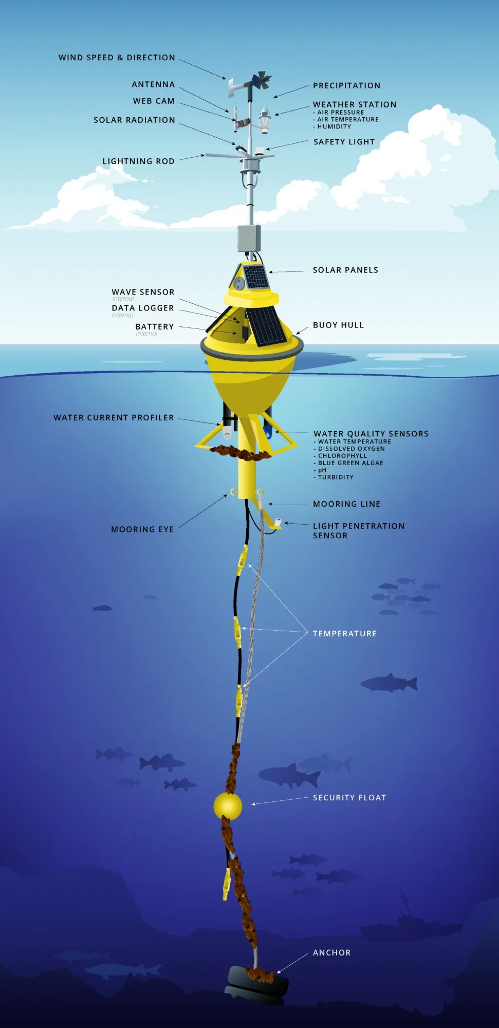
Most of what you see on In The Lakes starts here: a yellow buoy, anchored in open water, feeling the lake every minute.
Take the tour
Drag to turn it, pinch or scroll to zoom, and tap any part to see what it does. Pick a buoy to fill in what its sensors are reading right now.
Tap a part
A Great Lakes buoy
About two metres across and taller than a person above the water, with a line of sensors hanging all the way down to the lakebed. Tap the mast, the hull or anything below the surface.
A year in the water
Most Great Lakes buoys are seasonal. Crews put them out in spring, once the ice is gone, and bring them in each fall, before ice can crush them or drag them off station. That's why the map goes quiet in winter: many buoys are on shore being cleaned, repaired and recalibrated, and the site leans more on satellites, shore stations and models until spring.
Who runs them
No single agency owns the buoy network. Environment and Climate Change Canada, NOAA, universities, water utilities, power plants, conservation authorities and private companies each look after their own. The Great Lakes Observing System (GLOS) gathers many of them into one open platform, Seagull, so anyone can use the data, including this site.
From the buoy to your screen
- The buoy measures. Sensors take readings every few minutes, and the data logger in the hull bundles them up.
- It phones home. The antenna sends the readings over the cell network, or by satellite far offshore.
- Seagull shares them. GLOS collects readings from many operators and publishes them openly.
- In The Lakes picks them up. The site checks every 30 minutes and labels each number: measured by the buoy, estimated from wind where a buoy has no wave sensor, or an old reading when a buoy hasn't reported for over three hours.
What buoys can't feel
A buoy only knows the water around it, and only while it's out. The deep water between buoys, the winter months, and above all the lake floor are far less known: most of the Great Lakes bed has never been mapped in detail. Read about Lakebed 2030 on Data & Science →