Learn · Courses · Course 7 of 7
Course 7 · 4 lessons
Investigating the lakes
How we measure the lakes, what the dark, cold deep is like and why so little of it is mapped, how to do your own science with the data, and the sky above the water.
Read the video's text
Investigating the lakes
How we know what we know: buoys, the dark deep water, and science you can do yourself.
1 · How we know Buoys and sensors
Almost every number on the map was measured by a machine floating on the lake, sitting on a pier, or orbiting overhead.
Buoys work like floating weather stations, reporting wind, waves and water temperature. Here are the stations on our map, in the year each began.
2 · Into the deep Into the deep
Lake Superior's floor is 406 metres down. It's dark there, 4 °C all year, and the water presses about 40 times harder than the air at the surface.
Much of the lakebed has never been mapped in detail. In June 2026 an underwater robot named Kiyi reached the very bottom, the first visit in about 40 years.
3 · Science you can do Science with data
You don't need a research ship to do science on the lakes. You need a testable question, careful numbers, and the honesty to say what the data can't tell you.
Ask: how big can lake waves get? Roughly 1 wave in 3,000 is twice the height a forecast gives, so even a "1 m" sea can throw a 2 m wave.
1 in 3,000: waves is about twice the forecast wave height
The big idea
Ask a good question, measure carefully, and be honest about what the data can and can't tell you.
Lessons in this video: Buoys and sensors · Into the deep · Science with data
How do we know what the lakes are doing? This course looks at the buoys, sensors and satellites that measure the lakes, the cold, dark deep that is still mostly unmapped, and how to do your own science with the data on the map. It ends looking up, at the sky over the water.
Everything here is real data you can use: pick a buoy, download its readings, and ask your own question.
Start with lesson 1: Buoys and sensors: how we know →
The course on one page
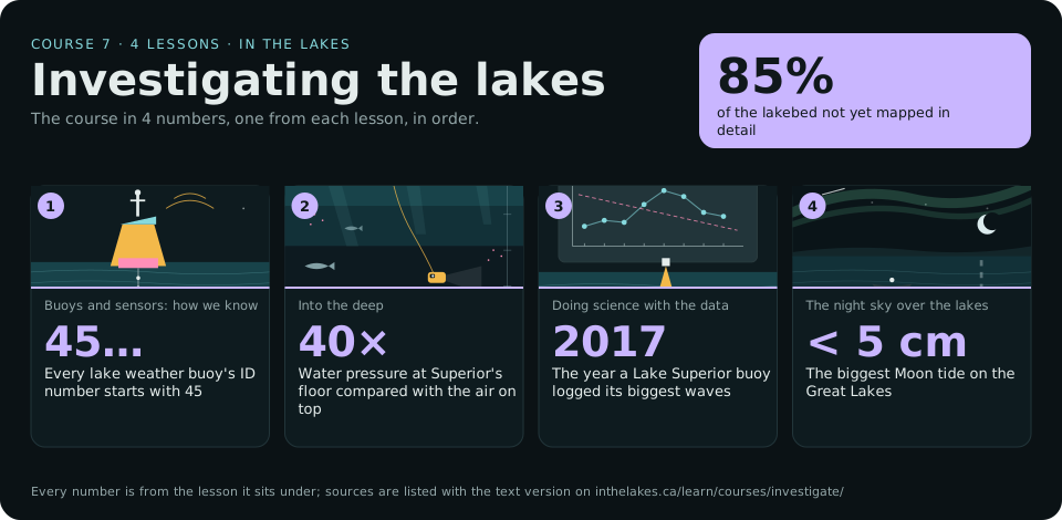
Text version and sources
- The whole course: 85% of the lakebed not yet mapped in detail. Source: Lakebed 2030 Conference (2024).
- 1. Buoys and sensors: how we know: 45…, every lake weather buoy's ID number starts with 45. Source: NOAA National Data Buoy Center.
- 2. Into the deep: 40×, water pressure at Superior's floor compared with the air on top. Source: NOAA Ocean Service: pressure and depth.
- 3. Doing science with the data: 2017, the year a Lake Superior buoy logged its biggest waves. Source: Michigan Public: buoy logs highest wave ever recorded in Lake Superior (October 2017).
- 4. The night sky over the lakes: < 5 cm, the biggest Moon tide on the Great Lakes. Source: NOAA Ocean Service: tides in the Great Lakes.
The lessons
Experience it in 3D
- The BuoyWhat the sensors measure, and how
- DiveLight, temperature and oxygen, down to the lake floor
- Take the helmThe night sky guide on a clear night
Unit plans that use this course
- Grade 7 Science: the lake as an ecosystemGrade 7 · Science and Technology · Strand B
- Grade 8 Water Systems, with live Great Lakes dataGrade 8 · Science and Technology · Strand E
- Grade 11 Environmental Science: testing the waterGrade 11 · Environmental Science · SVN3M / SVN3E